23 December 2012

Malta Ecological Park - 22 Dec 2012

Malta Ecological Park

Having failed at Gray's Crossing a second time, I decided to check out another park that I had seen a few times, and had confirmed the existence of trails within via a GIS link off of Saratoga PLAN's website.  This tiny park, called Malta Ecological Park, has about a mile of trails at the moment.  These trails explore various natural areas, including a small pond, and serve as a means of getting to and from an open field.  The sign at the pavilion near the entrance says that they may expand the park to include several more miles of trails, exploring more areas of the plot.

I did the outer loop once, exploring the area, and then settled in to doing laps on the trails that go around the playing field.  The outer perimeter loop is approximately 0.7 miles, and the inner loop showed up as 0.37 miles every time I ran it.

It's an interesting area, and I hope that they choose to expand it in the future.  As it stands, the trails all appear to be constructed of a thin layer of woody material on top of plastic sheeting, and they're all double wide.  There are no elevation changes of note (I varied from 280' to 310' across the entire course, and at no point did I actually see a hill).

Gray's Crossing - 22 Dec 2012

The Burl Trail

I went to Gray's Crossing for the second weekend in a row today.  I had gone there last Sunday, to check out the park that I had seen a few times while driving down Northline Rd.  It's a cute park, with a small picnic area right next to several bends in the Kaydeross (aka the Kayaderosseras Creek).  I had seen a trail leading off to the left of the picnic area, almost immediately, and when I saw a sign stating "Burl Trail", I got my hopes up that I had found another place to run in the area.  Unfortunately, it dead-ended after about a tenth or two of a mile.  The dead-end was a fenced off area, curiously with the words "Protected Area" on a sign on the OTHER side of the fence.

Today I went back, after having confirmed that I missed a turn to the left, and that I also missed the other half of the trail going off to the left right near the start.  I scouted out the area, using My Tracks so that I could see my (approximate) position on the map and compare it to the mapped version of the trail.  I scoured the area, but could find no evidence of a trail to the left.  The only conclusion I could come to was that the trail itself had been fenced off.

So, I backtracked and went down the other half of the trail, only to run into ANOTHER fence.  This one cut across the trail at a diagonal, and extended off in either direction.

The Burl Trail

This leads me to believe that either a) Saratoga Spa State Park fences off the trail during mud season, b) it's closed off due to the construction, or c) something else is going on and I'm completely missing something obvious.  I guess I'll go check it out again in late spring.

09 December 2012

Rowland Hollow Creek Preserve - 8 Dec 2012

Creek Overlook Trail

I visited two local areas today; the first turned out to be a bust, but the second was a total gem.  Rowland Hollow Creek Preserve is a new preserve (only a few months old, according to the brochure in the box), built beside a new housing development being put in along Grand Ave in Saratoga.  I went for a run here, and loved it.

The trails aren't very long, a total of 1.0 miles, making for a 1.15-1.20 out and back run.  I went clockwise around the loops, and got to see some of the prettiest woodland trails I've seen in a while.  Add to that the fact that it was drizzling the entire time, and it ended up being a magical day.  My first time through I ran the entire way, hitting each possible bit of trail at least once.  The trails are arranged as two lollipops (stacked on top of each other) with a dogleg down to the eponymous creek off of the second one.  In order, they run as white, red, then blue (then red, then white, then out).

After coming to the loop portion of the white trail, and going left, I was immediately presented with a wide trail, double or triple track, carpeted in pine needles and curving just enough to be interesting.  At the end of this is the intersection with the red trail, as well as a feeder trail going off to the right, which leads into and out of the road around the new development's stormwater pit.  Following the red trail, you drop down into the floodplain of the creek.  The short trail to the creek itself is pretty, especially at the very beginning, where a toppled tree presents a natural entranceway.  The creek itself is roughly 10' across and not very deep.  I didn't see any signs of life in the creek itself aside from plants, but it's the wrong time of year to see things.  The temperature stayed in the 37-38 deg F range while I was out.

I headed back around on the rest of the red loop and then the white loop.  This was the steepest portion, climbing out of the floodplain and then up along a minor hill until the trail leveled out again.  Along the way I came across a stone wall that looked like it had been partially removed to make way for the trail.  I made my way back to the parking lot, and then did the whole thing again, this time taking walking breaks to take photos and explore some.

All in all, it was a fun run.  It's a tiny network, unsuitable for anyone looking to run any sort of distance, but I would say it's perfect for someone who is just starting out (like me).  The beauty is captivating and motivating at the same time.  This is also a perfect place to take kids for a walk in the woods.

I'd also like to say thank you to the people responsible for creating this preserve.  Thanks!

Pics are here.

07 December 2012

Blackhead Mountain and Arizona Ridge - 23 Nov 2012

Blackhead Mountain

Ken and I set out from his house around 07:45, and were at the trailhead by 08:10.  We geared up and headed out 10 minutes later.  The first stretch of this trail follows some kind soul’s driveway, and after that it follows the remains of a road through Dutcher Notch.  For the first segment of the road, there are private lands on either side, but eventually it comes to state lands.  Before we could do any of that, though, I had to double back and get my phone, which I had left on top of Ken’s truck.  It wasn’t the only thing I had forgotten.

Before we get too far into this report, I’d just like to give a “shout-out” to my trekking poles.  I really appreciate them, especially on steep, treacherous descents, where they help significantly.  My knees appreciate having some of the weight taken off of them, I’m far less likely to fall, and they engage my entire body in the exercise.  It’s unfortunate, therefore, that I left my poles sitting in the trunk of my car, parked at Ken’s house, a half an hour away from the trailhead.

Furthermore, I didn’t realize this until we were already headed up the trail.  I thought about going back for them, but I didn’t want to waste an hour or more on it.  So we pushed onwards.  10 minutes after heading up for the second time, we reached the register, and another 10 minutes after that, we were on state land.  The trail runs right beside the old road for most of its length, which is fortunate, because the old road was covered with several inches of leaves, which made it impossible to see what we were stepping on.

We made it up to the col (Dutcher Notch) by 09:30, and we hunkered down behind some rocks to our left, to get out of the wind a bit and have a snack.  15 minutes or so later, we started up the Escarpment Trail, literally up, passing first over more leaf-covered ground, up switchbacks, and then straight up into a more coniferous zone.  Along the way, I managed to scratch Ken on the head with a whipped branch.  I turned around to say “watch out” and the stupid thing was already scratching him.  To add insult to injury, the same tree got him on the way down.

After the climb out of Dutcher Notch, the trail opened up a bit, flattened out a lot, and we reached “Arizona”, a long ridge that may or may not be considered a peak, depending on what source you’re reading.  It doesn’t really matter; it was a pretty walk through the woods, and the going was mostly flat.  On the other side of Arizona Ridge, as I’ve decided to call it, we climbed down into the next col and then started our ascent of Blackhead proper.

At about 11:20, somewhere around the 3500’ marker, I started running out of gas, and I stopped to carb and salt up before the final push.  Ken joked that I would be at the summit before it kicked in, but Larabars work fast, at least in my body, and I was ready to roll after a few minutes.  We knocked out the last bit of ascent, arguably the most technical of the day, which is to say we had to use our hands a couple of times.  By 11:40 we were at Camp Steel, and a minute or two later we were at the summit.

The summit sits at the junction of the Escarpment Trail and the Blackhead Range Trail, and was windy, but just back on the trail we found enough shelter to eat a quick meal in relative comfort.  We remarked how we hadn’t seen anyone yet today.  At the trailhead there was one other truck, but the gigantic NRA sticker on his or her door indicated that he or she was most likely off hunting and not hiking up a mountain.  I took a quick walk down the Blackhead Range Trail, but saw no footprints in the snow.  I didn’t continue on the Escarpment Trail to look for prints, since it dropped down steeply, and I didn’t feel like climbing back up.

At 12:15 we headed out, and about halfway down into the col, we met the only other soul we would see on the trail that day.  We stopped to chat for a moment, then headed on.  I pushed the pace a lot on this stretch, where possible, and attempted to get over my fear of falling and my fear of my knees giving out and just ... bound ... down the mountain.  I thought about Reinhold Messner, his reputed deer-like grace on the hills in a National Geographic piece I had just read a month ago.  I thought about Sarah Lavender Smith’s write-up of her trip to Alaska, and her description of the “Geezers”, running down a snowfield in giant, bounding steps, sliding with every step. It worked, for the most part, though I wasn't quite bounding, yet.  I applied one of the few hiking lessons from my father that I can actually remember, and took quick, light steps down the steepest parts.  It was a leap of faith, for me, but my knee held up fine.  It was sore by the end of the descent, and for a good week after, but it held up.

When we reached the leaves, near the top of the switchbacks, the descent became downright treacherous.  We were in danger of and did fall several times on the way down, but we avoided serious injury.  Several times I froze briefly, unsure of where to step next, and I scolded myself for not bringing my poles.  There was no use in fretting about it, though, so I slid and skidded down.  Ken stayed close behind for most of the descent, but we spread out a bit over the sketchiest bits.

After making it safely down into Dutcher Notch around 13:30, we were on better ground for a while.  As we descended, though, the leaves on the ground grew thicker again, and there were several more stumbles, but it never got as bad as the drop into the Notch was.  We were back at the truck by 14:20, scratched and sore but otherwise unharmed.

Pics are here.

03 December 2012

Skidmore's North Woods - 1 Dec 2012

I had visited Skidmore's North Woods once before, recently, but I had been walking, and I had only explored the Red trail and the meditation trail; the latter was by accident.  Please note that the only activity permitted on the meditation trail is walking.  Although it doesn't show on the map, there is a connector trail leading toward a few benches, just off of the red trail.  Details and map are here: http://www.skidmore.edu/sustainability/northwoods/regulations.php.

Going... down.

Having missed both of my running workouts this week, I was keen to get out and cover some miles.  I set off at an easy pace, conscious of the snow, leaves and wet rocks under my feet.  I made it down the Red and onto the Blue trail, then around to the backside before I took my first break, both because my lungs were starting to get upset and because my brain was screaming at me to slow down.  Perhaps I sensed what was coming, but the next quarter mile or so was treacherous.  After that, I ducked down onto the Orange trail and explored that.  It's absolutely amazing, how many other (unmarked) trails and woods roads are present in these woods.

The Orange trail cuts across a stream, ducks down a side trail, and then a short while later, cuts back across the same stream, this time on a series of bridges.  It eventually comes to a crossroads, and then begins the climb that I had seen previously, which constitutes, far and away, the hardest climb I've seen so far on local XC trails.  Over 0.4 miles, it climbs approximately 120', along a winding course and over a series of steps at the end (it switches from the Orange to the Red trail near the top).  Nothing to write home about, in terms of trails, but it was interesting nonetheless.  It's tame compared to the 1000' over 1 mile pitches that seem to dominate the final pushes of ADK climbs, but I've only walked up those, and they usually require pauses on the way up.  I hope to be able to run up that last bit of the Orange Trail, some day, and perhaps even more difficult bits.

After that, I made my way past where I had turned off last time (onto the meditation trail, by mistake) and explored a bit around the water tower, before I managed to find the Red trail that I was looking for (the Red and Green trails are non-linear).  I made it one lap around the Red trail, running almost the entire time, and back up to the water tower a second time before my knee started to hurt.

Since I was (am) still recovering a bit from the Blackhead hike, I decided to drop down to walking for the remainder of the outing.  I still wanted to pick up some mileage, since I was down for the week, so I decided to walk the length of the Blue trail, which I did.  I poked my head down one of the Green trail lines, but since I didn't realize it was a valid trail, I didn't go exploring, since I didn't want to trespass.  The trail marker didn't look Green to my colorblind eyes; it looked like an abandoned marker.  I completed my loop and headed back to the car, coming it at just over 4 miles for the day.

All in all it was a good outing, but the rock/leaf/snow combination made this a bit more difficult than what I was expecting.

Faster

I realized that on my previous post, I made a mistake: I reviewed pace instead of time.  The speed trials that I had set up are done for the most part on a single course, with a specific start and end point, so that I can rule out GPS wobble.  On any given walk, my distance will be measured between 0.85 and 0.89 miles.  It isn't a huge difference, but when you're talking about a few seconds of pace difference, a tiny delta in the distance becomes significant.

So, here's the latest version of the graph, measured in time, instead of pace:

rubiTrack 2 - Speed Trials - View 4

Here are the significant data points:
  • 7 May 2012 - 13:45 minutes.  First data point.  The next 3 data points are all in the 13:50 and high 13:40 range.  This is my best time so far.
  • 23 Jul 2012 - Either 14:23 minutes or 13:13 minutes.  I'm not entirely sure what's going on with this one; rubiTrack says 13:13 minutes for the Active duration, and 14:23 for the Total duration.  I have 14:23 written down in my spreadsheet.  Looking at the graph, it makes more sense that it was 13:13.  It's also interesting that this is from the week that I chose to stop eating meat.  Since it's an anomaly, we can discard it.  It doesn't matter.  What matters is the next data point, and what happened after that.
  • 6 Aug 2012 - 13:26 minutes.  This is a clean reading; there's no discrepancy.  I measured a full 19 seconds faster than my best time a couple of weeks after going vegetarian.
  • 13 Aug 2012 - 13:37 minutes.
  • 28 Aug 2012 - 13:52 minutes.
  • 4 Sep 2012 - 13:59 minutes.  These data points are all leading up to the backpacking trip.  I'm getting progressively slower, despite regular walks to build up leg strength.
  • 14 Nov 2012 - 14:25 minutes.  I had been eating meat for a day, including a major creatine source the day before.  It was also colder than it had been in a while, and I got a cramp in my leg halfway through.  So, I'm OK with discarding this time.  It doesn't matter one way or another.
  • 19 Nov 2012 - 12:54 minutes.  Best time to date.
  • 3 Dec 2012 - 12:07 minutes.  Insane.  I knew that I was walking fast, and I was able to keep pushing hard until the end.  Of note: I had only eaten one meat dish and one egg dish between my last intense workout, a run on the 1st, and this walk.  The remainder of my protein sources during that time had been vegetable-based.
What I get from this is continued confirmation of what I suspected in my last post.  I was still building muscle while eating a vegetarian diet; I just wasn't able to push myself as hard in an intense situation.  I suspect very much that this does come down to creatine stores.  If it does come down to creatine, there seems to be a lag between when it's first ingested and when it's available, though that may just have to do with my body's enzymes.

At some point I'd like to revisit this, and see if I can achieve the same results on a vegetarian diet.  Clearly, there are people out there who are able to perform at a high level on a vegan diet (i.e. Brendan Brazier and Scott Jurek).  Furthermore, I found Susan Lacke's recent experiment with a Paleo-Vegetarian diet very interesting, and I might try that next time around.  For now, though, and for the foreseeable future, I'll continue on with my "flexitarian" diet.  (Or, if you prefer, "flexible pesco-ovo-vegetarian".)  While I might be able to get the results I'm looking for without the flexible portion, on a diet where I get my protein and other nutrients from plants, fish and eggs, that wouldn't work due to social constraints.  I don't think it would be fair to my wife for me to be eating fish at the dinner table, which she despises, and not eating the dishes that she kindly cooks for our family.  It's tough enough when I'm not eating meat.

Anyway, I'm done with this topic for now.  Back to the reports.

16 November 2012

I stand corrected...

I mentioned in part one of my Lake Colden / Mount Marcy trip report how well I had been doing on a vegetarian diet. I said:
"On the subject of food, this trip proved to me that I could survive (thrive) on a plant-based diet, even under heavy exercise. I had finally made the switch to vegetarian stick at the end of July (after a decade of attempts).  Adding to the complication was the fact that I was essentially eating like a vegan, since I had found out a few years ago that a good deal of my physical ailments were caused by dairy products."
Then I finished loading in my recent walk, hike, run and (exercise) bike data in to rubiTrack, an activity tracking software for OS/X that I was recently clued in to.  It comes with reporting capabilities, including the ability to review a data point (i.e. distance, pace) in a given set over time.  You can define sets by tags, location, time, distance, equipment and more.  While playing around with it, I stumbled across data that suggested something was amiss.  The most telling number came from my "Speed Trials", which are walks where I walk one of a few set courses as fast as I can.  I had known, from a spreadsheet that I used to keep, that my speed had decreased a little after going vegetarian.  I had no idea it was so obvious, though:

rubiTrack - Speed Trials - View 1

It becomes even more obvious if you remove the blank month (October), though, due to the way the graph renders:

rubiTrack - Speed Trials - View 2

My pace has absolutely slowed over time, after July, when I was approaching the 4 mph mark.  I cut out meat at the end of July.

Hiking also supports this view:

rubiTrack - ADK46 - VIew 2

That's insane.  The June hike is Lower Wolf Jaw, the September hike is Mount Marcy, and the October hike is Giant Mt.  The only thing I can think is that the long walk in to the base of LWJ and the flatter sections on the Marcy hike are skewing the numbers.  On Lower Wolf Jaw, my brother and I were stopping to catch our breath every 20' on the steepest portion.  Furthermore, we spent a considerable amount of time checking out a series of waterfalls at the base of the climb to the col.  (Perhaps the software is filtering out the stopped portions?)  On Marcy I did somewhat better, but I still had to stop often to catch my breath, and Ken was usually way ahead of me.  On Giant, however, Ken and I pushed hard and consistently throughout the hike.  We stopped occasionally, but I feel like we stopped far less on Giant than we did on Marcy.

That was my perception, at least.  I thought my performance on Giant was better than on Marcy, which in turn was better than on LWJ.  The numbers say something else entirely.

On the Giant hike, Ken let me lead, so I was setting a pace that worked for me.  That might explain the change in pace, but I would have assumed that a steady pace would be better than a slow, halting crawl.  On Marcy, Ken and I had just carried 50-60 lb backpacks for 5-6 miles the day before climbing Marcy using day packs.  I felt like I was floating without the heavy backpack.

There are other examples, too, but they're a bit more anecdotal.  I ran the same 5k trail course twice during this period, once in September and once in November.  I ran the one in November a full minute and a half slower, despite having kept active that whole time.  It's hard to say for certain, though, what caused this decline, since I had been doing more targeted cardio prior to the September run, and that may have affected the numbers.

On the flip side, the numbers for ~2 mile walks at about 80% effort trended towards an improvement while eating vegetarian.  Furthermore, on the anecdotal side, my leg muscles look bigger.  A lot bigger.  Whether this is due to a size increase, a reduction in fat, or both, though, I'm not entirely sure.  I am at about the same weight I was went I went vegetarian.  The muscle change could all be in my head, since perception is a funny thing.

So, where does that leave me?  There are a few more points to consider.

Prior to this effort, I had tried several times to make a vegetarian diet work, and failed miserably.  In recent years, when I had tried, I actually became angry a few days to a week after making the switch.  It was this that caused me to try a semi-vegetarian diet (called "flexitarian" by those who like portmanteaus, like myself).  This provided a good balance, and seemed to work, but I wasn't fully committed to it, and after a while I found myself eating meat twice a day again.

This time around, I finally managed to come across a forum where another person was going through the same thing.  The suggestion there was to increase fat intake.  I tried that, and it worked.  I don't fully understand the mechanism.  My best guesses deal with the fact that our brains are mostly fat, and also that fat (cholesterol) is used in the synthesis of testosterone, but I honestly don't know for sure what caused the change in attitude.  I do know that eating more fat helped, and I began supplemented with flax seed oil in addition to eating olive oil on some portion of dinner almost nightly.  I also started using coconut oil for some cooking.

Other nutrients followed, and soon enough I was supplementing several times a week with protein powder and daily with brazil nuts (for selenium).  I also was careful to ensure that I was getting enough lysine every day; roughly 5-6 servings of legumes (or pistachios) were required to make this work, most of which came in the form of soy milk (which also provided calcium), peanut butter, and cooked beans.  On the subject of calcium, I was also careful to split my calcium-rich meals from my iron-rich ones, and to consume vitamin C-rich foods with at least one of the iron-rich meals.  In short, I read up at much as I could, and I applied it as best I could.

So, I don't think I was too deficient in terms of nutrients.  I also supplemented with vitamins to hedge my bets.

One more point:

A friend and former co-worker stopped by the office where I work the other day, and we got to talking.  He had been one of my motivations for going vegetarian, since he had been able to make it work for years, he was fitter than I was, and significantly faster on the trails than I am.  I mentioned to him that I had finally made being a vegetarian work, and his response was that he had eaten beef the other day.  I would have been shocked, except that this isn't the first time that this exact same scenario has happened.  Several years ago, another friend and former co-worker went from vegetarian to eating meat occasionally around the same time that I had made the switch to vegetarian.  She had been a vegan at the time we first met, and had eventually made the transition to lacto-ovo vegetarian, before finally beginning to eat meat again.

What this told me, the second time around, was that it can be difficult to maintain this diet.  In both cases, the reasons for eating meat were at least partially, if not wholly, driven by social aspects.  I drew the conclusion that it's difficult to sustain a vegetarian diet when your partner doesn't follow the same diet.  It's difficult to cook in this situation, because you're preparing two protein dishes for almost every meal, and potentially two starch or vegetable dishes, depending on everyone's requirements and tastes.  Furthermore, and this came up during my recent conversation, when you're visiting someone's house, it can be a bit difficult to turn down food that someone has prepared for you.

I could probably go on, but I'll skip to the conclusions.

I like my vegetarian diet.  It has forced me to learn and grow, and my meals are more healthful as a result of that.  I also feel like it's working, and I don't feel like I'm wasting away as some friends cautioned that I would.  However, I cannot deny the fact that my pace has slackened over time, despite continuing efforts to increase my pace that had been working prior to the switch.  I cannot say for certain that this is directly caused by my switch the vegetarianism, but I can say that it correlates.  The social aspects are taking their toll, too.  My wife has been incredibly supportive, but it's difficult for her to prepare meals when Thing 1 and Thing 2 are so picky, and I'm off preparing and eating my own food. 

I think that a vegetarian diet can be perfect for endurance sports, which by the way, a lot of people use it for.  No Meat Athlete is published by and read by people who run half marathons and up as well as triathlons on a vegan or vegetarian diet.  It absolutely works.  Brendan Brazier's success with a vegan diet also shows how well it can work at the ultra and triathlon level.

The problem is that it isn't working for me, once again.  I engage in activities that require both endurance and strength, sometimes explosive strength.  So, I'm starting to integrate fish and meat back in, in small quantities, while maintaining roughly the same diet otherwise (a semi-vegetarian diet).  Hopefully that will give me the results that I'm looking for.  I might give vegetarianism a try once again in the future, when I can keep a tighter control on the variables and determine more conclusively if I can make it work.  I want to make it work, and I'm a bit disappointed that it didn't this time around.

C'est la vie?

P.S. Dr. Google says the missing ingredient might be creatine, which we produce within our bodies, and also ingest through meat or supplements.  I sincerely hope that isn't it.  I tried supplementing with that years ago, for other reasons.  While the results were promising, I didn't like the way it made me feel.

15 November 2012

Mount Marcy and Lake Colden - 13-14 Sep 2012

This part two of my Marcy / Colden report.  Part one is here: http://tenfeetsquare.blogspot.com/2012/11/lake-colden-12-sep-2012.html

13 Sep 2012 (Day 2)

After a rough night, I was up at 06:15, and I was freezing.  I threw on extra layers and then took a brisk walk to warm myself up and explore a bit more of the area.  Ken woke up a little while after I got back, and we busied ourselves with filtering and boiling water.  By 09:20 we were on our way, and we took some time to explore the Opalescent.  The reports of her beauty are all true: she’s a fantastic river, and the sound of water flowing and rocks banging into each other filled our campsite.  To me, it added to the perfection of the campsite, especially at night, when there was nothing else to hear.

While we were exploring the Opalescent, Ken went to climb up a waterfall, and asked me to take some photos of him doing so.  I did, and then went to meet him further up the trail.  We missed each other (I underestimated where he would rejoin the trail) and spent a few minutes looking for each other.  When we finally did find each other, we resumed our exploration, only to look up and see that someone was carrying a very large, tarp-covered object down the trail.  We stepped off of the trail to let him or her past.

To our surprise, it was a guy carrying a gigantic painting.  He had carried it all the way up to Lake Tear of the Clouds so that he could paint there, on location.  He had stayed the night, and had a full backpack in addition to the gigantic painting.  We would later find out that he stayed the night at the Feldspar Lean-to with his girlfriend.  While they were there they met another hiker, Bret(t?) who had found the walking stick that he was currently using to support himself and his gigantic painting.  We found all of this out after the fact, though; at the time, we were simply in awe of what he was proposing to do.  By the time we had ran into him, he had made it through most of the difficulties; the worst hurdle left to him was the rise just past Lake Colden, and then he was pretty much home free to Upper Works.  Well, as home free as a person can be with a monstrous piece of art strapped to their back.  Gabe was apparently the only one amongst us who saw the painting itself, though I hope to see it myself someday, too.

We watched him walk away, hardly believing what he was doing, and then continued on up.  There’s a fantastic chasm that the Opalescent flows through at one point, marked as a flume on the map, and we stared at that for a few minutes before continuing on.  The majority of our trek up alongside the Opalescent and then through the valley between Skylight and Colden was over unseasonably wet ground.  I can’t imagine what it must be like in the spring, but it was sodden even at the end of a dry summer.

By 10:45 we were at the junction with the Lake Arnold trail, and we turned yet again, to start heading through the valley between Grey and Skylight.  At 12:15 we were standing at the outlet of Lake Tear of the Clouds.  5 minutes earlier, we had stood at a spot almost directly across from Grey Peak, and we had seen our first glimpse of Marcy.  She looked huge, distant, and stark.  I knew that the last push would be over exposed ground (in both meanings of the word), the Schofield Cobble, but the entire pyramid that was visible to us was bare rock.  Ken posed for a few shocked photos with his index finger pointed at the summit.

We were contemplating turning around, since we were behind schedule, and needed to have dinner cooked and eaten well before 19:00 in order to reduce the likelihood of a bear encounter.  As we did the math we realized we would be cutting it close.  A few minutes later, though, we met a gentleman older than ourselves, who had just climbed it (a common theme for the year: getting schooled by older, fitter, gentlemen).  He gave us approximate times of an hour and a half up, and forty five minutes down.  We made it to Four Corners by 12:30, and resolved to press on.  The going became increasingly steep at this point, but by 13:00 we were in the alpine zone, and by 13:30 we were on the summit.  Gabe was already there, sitting down and enjoying the magnificent view.  Ken chatted with Bret(t) for a while, and we all chimed in to the general conversation happening up there.  There was discussion about the Artist, most of which I’ve already recounted.  Bret(t) also mentioned how he had just completed a 3 day trip through the Pharaoh Lake Wilderness where he saw not a single other soul.  (When I looked it up on the map, I realized that it was directly south of my uncle’s camp on Paradox, and that some of the trails feeding it led off of route 73.  I had no idea that stretch of land was so remote; the areas that surround it are so populous: Schroon Lake, Ticonderoga, and the smaller villages along the way: Severance, Paradox and Eagle Lake.)

We headed off the summit at 14:00, gingerly made our way down the Schofield Cobble, and finally made it back to Four Corners by 14:30.  I had left my poles at the campsite, because I didn’t want to scratch up the Cobble and the delicate lichen with the tips.  This was a serious mistake on my part, and it ended up slowing down my descent significantly.  There were a few spots on the Cobble where I felt so off balance that I thought I was going to fall.  Mercifully I didn’t.  I suppose you could view the poles as crutches, but they definitely help with the descent, both in terms of balance and keeping some of my weight off of my damaged knee.

Regardless, we made it back to camp by 17:00.  Ken stayed far ahead of me for the majority of the descent, but when we met up at a stream crossing, he had me go first so that I could pace him.  We kept that up for the remainder of the descent, and it seemed to work, in that it kept him free from injury, aside from blisters.

Just before the bottom, on the umpteenth log-over-mudhole crossing, I slipped and fell ankle deep into the mud, enough that the mud started to come inside my boot.  I managed to get out quickly enough, I suppose, but the damage was done.  Back at camp, I took a quick step in the Opalescent to try and get some of the mud off, but this was a mistake.  Had I waited until morning, I could have just scraped it off.  My boot was wet for the remainder of the trip.  There wasn’t enough daylight left to really dry it out that night, unfortunately, and there wasn’t sufficient time the following day, either.

We went for a walk around the site at 19:00, and noted that there were significantly more people around than on the following night.  We had chosen wisely, it seemed, by going from Wednesday through Friday instead of Thursday to Saturday, as I had originally planned.  While we were out, we discussed Gabe, and the fact that he hadn’t caught up to us on the way down.  He had said he was going to head out soon when we had left, and since I was moving so slowly down, we had fully expected to get passed by both he and Bret(t).  As it turned out, we saw neither by the time we reached the Lake Arnold trail, at which point Bret(t) would have turned right to get to his lean-to.

Gabe didn’t show up in our site until 19:30.  He said that had just fallen in the Opalescent, and he looked like a wreck.  We chatted for a bit, and made sure that he was OK to get back to his site, and that he had enough food.  After he went on his way, Ken and I stood around for a while discussing the sort of things that men discuss around campsites, and waited for the stars to come out.  By 20:30 we had retired to our respective tents, and by 21:15, I had passed out.

14 Sep 2012 (Day 3)

My notes aren’t quite as good for the last day, but I have GPS data and photos to fill in the missing details.  We must have woken up around 07:00 or earlier.  I remember being freezing once again.  By 07:50 I had gone for a walk to use the pit privy after breakfast.  I decided to push a little bit further on down the herd path, to see if I could figure out where Gabe’s lean-to was.  I didn’t find that, but a minute or two down the herd path I found an awesome view of the river south of Lake Colden’s dam.  Again I could see the intense high water mark etched into the side of the rock, and again I wondered if I was truly seeing the effect of Irene, or if that was the normal seasonal mark.  Either way, it was several feet above the current water level.

I headed back to camp, and finished packing up.  Ken had already packed up in my absence, and was itching to go.  This is always the hardest part for me: breaking down the site.  We had kept it light, and relatively tidy, so there wasn’t much to do aside from roll a few things up and shove it into our bags.  By 09:00 we were just about ready to go, and by 09:10 we were on our way.  I had briefly considered hiking out in my trail running shoes, since my boots were still soaked from yesterday’s mud pit, but I wasn’t sure how I would do with no ankle support and an extra 40+ lbs on my back, so I went with my boots.

Five minutes later we were on the dam, taking a few more pictures.  We continued on, said hello to the two EMS employees that we ran into along the way, and make it back to the Henderson monument by 10:05.  An hour later we paused on the banks of Calamity Brook to filter some more water.  We were (are) both neophytes when it comes to the whole process, and it ended up taking about half an hour to have a snack, filter water (which takes anywhere from 2-5 minutes per liter depending on how adept you are) and then wait for the disinfectant to prep (which takes 5 minutes per liter).

At 12:00 Ken located the site of one of the former bridge crossings.  We took some pictures, and I finally managed to get my bearings in regards to where the trail was changed.  As we continued on, I realized that we were on the remains of a woods road, which I distinctly remembered from my previous hike nearly a decade earlier.  Then, however, it had looked more like a pleasant country lane.  I remembered it looking completely out of place, but it was etched in my memory as one of my favorite spots.  As I stood there 8 years later, it took me a while to overlay the two.  I’m not convinced that I fully have.

20 minutes later we were back at the bridge where we had taken our first break on the way in.  I made a small sacrifice to the chipmunk gods (in my exhaustion I failed to open my bag of trail mix correctly and ended up spilling nuts all over the place).

At 1:00 we rolled in to the Upper Works parking lot, noticed the increased number of cars in the lot, and headed out.  We stopped at the Dunkin Donuts in Warrensburg (gas station) and also the Stewart’s, and then Ken dropped me off at my house.

All in all, it was an excellent hike.  Oh, and since I mentioned this hike on the Giant Mt report, here are the ascent details for comparison, taken straight out of Garmin Connect:

Giant Mountain via the Roaring Brook Trail: 3357’ climbed over 3.67 miles in 3:16 hours
Mount Marcy from Lake Colden: 2690’ climbed over 4.70 miles in 4:05 hours

Granted, we spent 15 or so minutes wandering around the Opalescent and talking to the Artist.  I’m still of the mind that we did better on Giant, however.

12 November 2012

Rest In Peace, Ursa americanus yellowyellow

I had heard earlier this year from an employee at EMS that Yellow-Yellow, one of the more famous bears among campers in the High Peaks region, had been killed.  When my friend and I ran into a Ranger and a DEC employee with a shotgun at the Lake Colden dam, I asked them about this, and they confirmed that she was still alive.  Today, however, there's news that she was shot by a hunter.

The story is here: http://www.adirondackdailyenterprise.com/page/content.detail/id/533958/Famous-bear-bandit-is-killed.html

There's an excellent write up on her here, and an explanation on why she was vital to the region: http://www.adirondackexplorer.org/stories/bears.php

In short: She forced campers to keep their food safely and correctly stashed, or else risk having to cut their trip short because they had no food.  She also helped keep more aggressive adolescent male bears on the move.  It'll be interesting to see how the dynamic changes now.


Updated on 15 Nov 2012: Dan Crane wrote an obituary for Yellow-Yellow, here: http://www.adirondackalmanack.com/2012/11/a-yellow-yellow-obituary.html

11 November 2012

Lake Colden - 12 Sep 2012

It has taken me nearly 2 months to finally sit down and write this, so some of the details below may not be completely accurate.  Ken’s memory is usually better than mine, so I may need to make some adjustments if I make any egregious errors.

I met this hike with nervous anticipation, and more than one freak out.  A day or two before we set off, I went in to EMS, furiously debating with myself whether or not to bring a ground pad or not, and whether or not I should bring the one I already had (a simple but light foam pad) or invest in something lighter and less bulky.  I had packed my pack the night before and realized that the bear canister took up so much room it was ridiculous.  I had also considered buying a specially made bag that is designed to hold the canister, thus allowing it to be lashed to the outside of a pack.  (It’s difficult to lash the canister to anything without a bag holding it; this is by design, to make it more difficult for a bear to get a good grip on it.)

The poor associate who finally asked if I needed any help was incredibly helpful, pointing out the various options, including the one that she herself used for multi-day cycling trips.  She also reminded me of other ways to cut down on volume, like breaking your tent down and lashing the poles to the outside of the bag.  In the end, I chose not to buy a pad at that time.  I ended up lashing the foam pad to my bag, and then taking it off when we got to Upper Works because it wasn’t cooperating and I thought I could do without it.  Thermodynamics disagreed.

On to the report.

12 Sep 2012 (Day 1)

Ken picked me up at my house at around 08:30 on the morning of Sep 12th, and after many protracted goodbyes from my family (especially Thing 1, who was particularly distraught), we set off.  We made our way up to Upper Works, stopping at the Dunkin Donuts off of exit 17 to grab a coffee for Ken.  This is part of our camping ritual, but the significance of it escaped me at the time.  I was already drinking hot tea out of my travel mug, and had no desire to partake in the headache inducing grandeur of DD.  After that we made our way up through Warrensburg and North Creek, up past the MacIntyre furnace and the abandoned village of Adirondac/Tahawus to the Upper Works trailhead.  We geared up and headed out at 10:40.

At 11:25, we took our first break at a relatively new bridge across a small brook.  We took our packs off, which is not something I normally do, but it was a welcome relief.  I had cut the weight of my pack as much as I could, but it was still about 40 lbs dry (add another 6 for a full hydration bladder).  Ken’s was even heavier, closer to 50 lbs dry.  We continued on from there, and ended up stopping about once every mile or so after that to take our packs off and rest for a few.  I avoided sitting down to reduce the likelihood of a cramp.

I kept my eyes open for the point at which the old trail cut away or rejoined our trail, but I missed it on the way in.  Irene had washed out two of the bridges across Calamity Brook, and the DEC had chosen not to repair them.  They had instead cut a short connector trail between the old logging road that we had started out on and the bridge that we took our first break on, which was along the trail to Indian Pass.  When I had first heard about the change in the trail, I thought it was a good idea, because I remembered that there were several crossings, and it had seemed a bit silly.  Unfortunately, one of the bridges that washed away had been a personal favorite of mine.  We found the remains of it on our way out, and it saddened me.

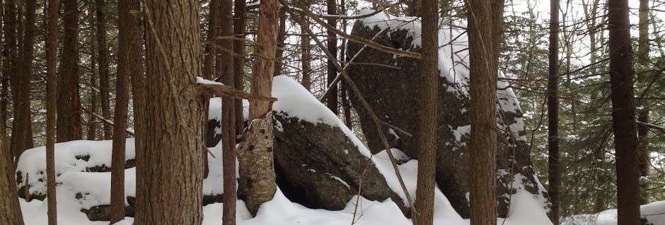
While I’m reminiscing about the way the trail used to be, the biggest change of all that I noticed was on the first leg of the trek.  Originally the trail had followed an old woods road through a relatively barren plain.  If I’m not mistaken, this was the result of logging operations after Floyd.  Now 8 years later, the woods had grown up significantly, and the bleak desolation that had been there was gone.  I missed this, as well, but it was also interesting to see succession in progress.

Onwards.

By 12:30 we were at the last major crossing of Calamity Brook; the high water bridge looked like it had seen better days, but the water was low enough that we could cross on the rocks without a problem.  We made our way up, and by 13:30 we were at the Henderson Monument on the far side of Calamity Pond.  Again, I was amazed at the difference between this hike and my previous hike here.  On that last hike, my mom had asked my brother and I to go with her with the expressed purpose of visiting this very spot.  We had gone along, still sore from a monster hike the weekend before (a traverse of Pitchoff, Porter, and Blueberry, with the requisite side jaunt up Cascade, ending up in Marcy Field).  When we finally did get to the monument, we were forced to admire it from afar, since the water around it was at least 18’ deep, if not deeper, and it was October and cold.  That day had been grey, and dreary, but today was sunny and beautiful, and we walked out to examine the monument.  The high water mark from Irene was visible on a rock across the water, and I remember it being about level with my head.

We continued on up the trail, and made it to Flowed Lands by 14:00.  Ken signed us in, and we continued on, checking out the campsite right at the junction in case we needed to use it.  We made our way up and over a small rise of land (described as a “rocky promontory” in the guidebook).  This was arguably the most technical terrain we had encountered so far, and a few of the faces proved interesting with big packs on.  Nevertheless, by 14:50 we at the dam at the end of Lake Colden.

We didn’t linger too long, since we were eager to find a campsite and drop our packs for the night.  A sign on the other side of the dam indicated that the campsites were on a trail to the right.  We followed it, and were immediately introduced to the Opalescent.  Ken spotted a “camp here” marker across the water, so we dropped our packs to go investigate.  He was far more confident on that crossing, and by the time I had made it across, he had already scouted out the land and found an excellent site.  While I was looking around, I noticed Ken hopping across the river with both his pack and my pack.  Stunned, I thanked him, and we relaxed for a few while changing our footwear.  While we were relaxing, a gentleman who sounded like he was from Eastern Europe came through our area and chatted with us for a while.  He talked about the lean-tos in the area, and how no one wanted to share their lean-to.  On the Appalachian Trail, he said, this would never happen.

This pattern, strangers wandering through our campsite, would repeat through the entire trip.  Although we hadn’t known it at the time, we had chosen the first of several campsites on the south side of the Opalescent, and so a decent amount of foot traffic went past our site every day, even, apparently, during the middle of the week.  A short while after the first man left, another one walked past our site, but didn’t stop to talk.  He had long grey hair and a long grey beard, and so I nicknamed him Rondeau in my mind.  He did say “hello” when I said “hi” when we ran into him on the herd path a short while later, but he seemed keen to avoid people, so I didn’t attempt to start a conversation.

At some point in here, either before or after we changed out of our boots, I went to filter water for the first of many times.  I had drank an entire 2+ liters down on the way in, and I was parched by the time we pulled in to camp.

After we had changed footwear, I was in need of a cat hole or a pit privy, so I said I was going to go search the area to see if the latter existed.  Ken doubted that one would exist, but I had seen one the previous year at Marcy Dam, and since it made sense to build one wherever a dense collection of camping sites exist, I figured that there must be one.  I didn’t relish the thought of finding a decent spot in the woods.  Next time I’ll know better, and just dig a cat hole.

We followed the herd path that led through the campsites first to the right, which brought us to the bridge over the Opalescent (d’oh).  Back on the other side of the river, we followed the short trail back to the dam, without finding a privy.  We crossed the river again, back to the campsite, and headed down the herd path in the other direction.  This led us past several camp sites, a lean-to, and eventually, a sign for a campsite and a toilet.  I made my way over and relieved myself, but the entire time in there was a bit nerve wracking.  The planks comprising the seat were clearly cracked on the right-hand side, and it looked like the entire thing might collapse at any moment.  Furthermore, while looking in the latrine, you could see the open ground behind the structure, because the back half had been opened up.  The pit was still more or less intact, but the bottom quarter of the back wall was just gone.  Add to all that the fact that the seat leaned back at a bit of an angle, making you feel like you were constantly just about to fall in.  Despite all that, I was still grateful for the convenience, but I think I’ll be avoiding the privy on subsequent trips.

By 17:20 we had set up our tents, Ken had rigged a clothesline, and we had filtered enough water for hot drinks and meals.  I lit the stove, only to belatedly realize that I had forgotten to remove the plastic covering the bottom coils.  I turned off the gas, but not before a 3’ hole had been burned through the bottom cover of my stove.  We cleaned the plastic off of the burner as best we could, and then then started to heat up water once again. Dinner was in the form of dehydrated meals: some meat and potato variant for Ken, and Backpacker’s Pantry’s Katmandu Curry for me.  We had caffeinated drinks as well, which helped with the post-hike recovery.  I discovered at some point on this trip that Twinings’ Darjeeling tea is fantastic in this setting, much better than my usual go-to cup of Irish Breakfast.  Ken made use of Folgers’ Coffee Singles (coffee in a gigantic tea bag).

On the subject of food, this trip proved to me that I could survive (thrive) on a plant-based diet, even under heavy exercise.  I had finally made the switch to vegetarian stick at the end of July (after a decade of attempts).  Adding to the complication was the fact that I was essentially eating like a vegan, since I had found out a few years ago that a good deal of my physical ailments were caused by dairy products.  I had read up on the subject (of vegan health) quite a bit, and had spent hours making sure that the food I was bringing with me would provide me with enough of the core minerals I would need (i.e. iron and calcium) and enough of the protein lysine.  The Katmandu Curry was essential part of this; the lentils that form its protein base are an excellent source of lysine, as are the pistachios that I had included in every bag of trail mix.  The curry dish also provided ginger and turmeric, two anti-inflammatories, making it quite possibly the best vegan option from the Backpacker’s Pantry line-up, if not the best vegetarian one, in terms of hiking and backpacking fuel.  The only nutrient I really found myself craving at the end of each day was vitamin C.  I had contemplated bringing a few plastic containers of pineapple but didn’t want the weight.  I should have just packed a few vitamin C pills.  Oh well.  The vitamins I had brought along ensured I wasn’t completely deprived of it.

Anyway, enough of my ramblings.  Onwards.

After we finished dinner and stashed the bear canisters, we took another walk around the area.  We made our way over to the dam, so I could try to get some photos.  I had noticed that the light had turned golden while we were cooking dinner, presumably due to the sun’s position in the southwestern end of the valley that we were camped in.  I had hoped to get over to the dam so I could get a few shots of Colden bathed in this light, but the timing didn’t work out.  However, while we were doing our exploring, we did meet up with a ranger and a DEC employee armed with a shotgun.  We chatted for a few minutes; the ranger confirmed that we weren’t camping too long without a permit, and that we had our food properly secured.  I asked gentleman with the shotgun if it was for bear training, and he confirmed that yes, they were out looking for bears, and that the gun was for hazing the bear should they come across one (as he put it).  It was a bit late in the season, they explained, and this weekend would be the last time they would make these rounds.  As it turned out, we saw very little wildlife while were there, and nothing larger than a chipmunk.

Which reminds me: while we were cooking dinner, I looked up a few times to see a chipmunk peeking out from behind a tree, staring at me.  It seems that every campsite we stay at is also home to a chipmunk, and this one was no exception.  Every time we cooked our meals he would try to get close enough to steal some of our food.  We didn’t feed him, but that didn’t stop him from trying.

We took a few pictures off of the dam, and then headed back to camp.  By 7:30 we were in our tents settling in for the night, but not before we had one last visitor.  As night was descended, another hiker came through our area, making his way via a wreck of a herd path to his lean-to.  It may have been a clear trail at one point, but the repeated flooding of the area, especially Irene, had accumulated a significant amount of debris across this terminus.  It seemed that we were camped on the flood plain of the Opalescent.  It would have been very wet in the spring, but in the fall it provided a perfect campsite: flat, sandy and nearly devoid of roots, twigs and stones.

The guy who wandered through our area said that he had been up at Lake Tear on his way up to Marcy, at about 16:00, but he had turned around at the tarn because of the late hour.  Another hiker up there had told him he would have been hard-pressed to get up and down Marcy in the light, which was sound advice.  He said he was going to give it another try tomorrow, and as we said our good-nights, we wished each other luck and said we hoped to see the other on the top tomorrow.

His name was Gabe, but I didn’t find that out until the following day.  That evening, in my notes, I referred to him as Wolverine, due to the style of his facial hair.  In my head I also thought of him as Thoreau, off finding his wilderness, as he tromped through the woods and the wet to get to his lean-to.

As I settled in for the night, my legs started to cramp up.  I was upset at myself for not bringing a ground pad.  The ground was a gigantic heat sink, and even a thin piece of foam would have been better than nothing.  At 20:30 I headed out of my tent to relieve myself and try to stretch my legs a bit.  I happened to glance up and was blown away by the stars.  There were no artificial lights nearby, except for the faint glow coming from Ken’s tent.  I saw a satellite floating by overhead; it looked large enough (and bright enough) to be the ISS, but I didn’t confirm it.

Sleep was slow to come, due to the cold, but exhaustion eventually knocked me out.  I had intended on sleeping in just boxers, since I was in a 40 degree mummy bag and the night was well within its range, but I ended up throwing on my long underwear and long-sleeve top.


I'll post the next segment of this report soon.  I wanted to break it up a bit since the report is so long.

09 November 2012

Geek: Dealing With .vnt Files

I switched this year from an iPhone to an Android phone, for a few reasons, which I might get into at some point in the future.  I use the Memo app on 'Droid to record notes; very often I use it to keep track of my weight before a hike, as well as the weight of my gear.  Getting data out of the app proved to be annoying.  I can export it to my computer through Dropbox, but it's in a .vnt format, that looks an awful lot like a vCard format, but I couldn't find any pre-built software capable of parsing it.  I was, however, able to come up with a quick workaround.

N.B.: this post assumes that you have a basic working knowledge of Linux, FreeBSD, or some other Unix or Unix-like system.  It assumes that you can install packages (vpim) on your system, and it also assumes that you know HOW to install packages (or compile software from distributed source code).  It also assumes that you have already have exported the Memo that you wrote on your Android phone into a .vnt format file.  It assumes that you are staring at that file, debating whether or not to just do a search and replace on those =0D=0A characters, and wondering why the Memo app couldn't just export a text file.

The .vnt file looks like this:
[doug@airship-pirate work]$ cat 2012-11-09.21.49.18.vnt
BEGIN:VNOTE
VERSION:1.1
BODY;CHARSET=UTF-8;ENCODING=QUOTED-PRINTABLE:Test=0D=0A=0D=0AMessage=0D=0AHere
DCREATED:20121109T214918
LAST-MODIFIED:20121109T214918
END:VNOTE
[doug@airship-pirate work]$ 
So, the content is in there, "Test Message Here", but it's a bit hard to work with.  You have a few options for translating this.  The most robust way is to use a vNote reader, but I have yet to find one, or have reason to write one.  So we'll use a vCard reader instead.  The package "vpim" provides a few utilities, including vcf-dump, which we'll exploit for our own nefarious purposes in just a moment.  First, though, we have to tweak that VNOTE into a VCARD.  If you don't do this step, vcf-dump gets all cranky.
[doug@airship-pirate work]$ sed -e 's/VNOTE/VCARD/' 2012-11-09.21.49.18.vnt > 2012-11-09.21.49.18.vcf
[doug@airship-pirate work]$ head -1 2012-11-09.21.49.18.vcf
BEGIN:VCARD
[doug@airship-pirate work]$ 
Easy enough.

Next, run it through vcf-dump:
[doug@airship-pirate work]$ vcf-dump 2012-11-09.21.49.18.vcf
..Begin="VCARD"
..Version="1.1"
..Body="Test\r\n\r\nMessage\r\nHere"
 ENCODING=[QUOTED-PRINTABLE]
 CHARSET=[UTF-8]
..Dcreated="20121109T214918"
..Last-modified="20121109T214918"
..End="VCARD"
Great.  vcf-dump handled translating that quoted-printable string, and presumably would handle other encodings as well (i.e. base64), without too much effort on our part.

Finally, the last step.  I'm going to grab that "Body" line, cut out the portion between the quotes, and then translate those CRLFs ("\r\n") into actual newlines. 
[doug@airship-pirate work]$ vcf-dump 2012-11-09.21.49.18.vcf | fgrep "Body=" | cut -f 2 -d '"' | sed -e 's/\\r\\n/\n/g'
Test

Message
Here
VoilĂ .

I hope that helps.  Please remember to back up any files prior to attempting to translate them, since one botched '>' can ruin your day.

08 November 2012

Scorn

This isn't the first time that this has happened.  I scoff at some thing that's different from what I'm used to, and some number of years later, I've completely reversed my position on it.

When I was younger, and spent more time in malls, my friends and I would make fun of the kids spending time on the DDR machine with their wallet chains flapping all over the place.  Fast forward several years, and I myself was standing at one of those very same machines, pounding out more and more aggressive rhythms.  It turns out that DDR is actually excellent for cross-training: it builds coordination and timing, in addition to aerobic fitness.  I even went so far as to purchase a used PS2 and a RedOctane Ignition mat specifically for the purpose of practicing DDR at home.

Trekking poles are another great example.  While out on the trail I would inwardly jest at the fools (so I thought) walking past with their poles.  "What in the world are they doing with those poles?  Just walk!"  Fast forward several years, and I'm bringing mine on almost every hike.  They serve a number of purposes, but my primary use is to increase traction, especially on the descent, where my injured knee becomes a liability.  They can also assist with the ascent, helping you up the random small rock steps and ledges you're bound to encounter, and they also help engage the whole body in the hike, which helps to build fitness.  As Dave "BIGfoot" Felkley puts it, in one of his sidebar notes on Gene Prater's Snowshoeing treatise:  "There is no reason to be in two-wheel drive while in four-wheel drive country." Obviously, he's referring to the additional balance that poles give you on snow, but the statement stands true on terra firma as well.

Which brings me to the point of this post:

VFF

These.  When I started this journey into running, I made a decision to that I was going to go minimalist.  It falls in line with the work I've been doing over the past few years to shed as much weight from my body and my pack as is possible while still being safe.  Shedding weight from my feet is a natural extension of this reasoning.  When I started looking for trail running shoes, one of the sites I looked at was Merrell, since I was already familiar with and a huge fan of their hiking boots and shoes.  I found their minimalistic Trail Glove, which was available in my odd foot size and positively reviewed on many of the sites I frequent.  I picked up a pair, and so far I'm loving them for trail running.  I wore them around the campsite at Lake Colden, too, and they did incredibly well in that capacity as well.  On that occasion, I wore a significantly thicker sock than I do for running, but I never felt like my foot was being squashed.  The Vibram sole on the Trail Glove also gripped the rocks just as well as the Vibram sole on my boots and hiking shoes, despite having almost no tread depth.  I was impressed.

The Trail Glove, however, still looks like a shoe.

I had already made up my mind years ago that I would not try on those funny toe shoe things.  My friend Rob had been running barefoot and minimalist for a while, and I just couldn't fathom it.  Furthermore, the shoes just looked... weird.  I openly derided them, and the whole concept of running barefoot, especially on trails.

I was up near the summit of Colvin last year, attempting to assist a few other hikers who had gotten stuck on the very last problem before the summit, an 8-10' scramble up a sloped rock.  There are excellent holds once you look at it (at least for someone who is in the 6' range), but I completely sympathized with the stuck hikers.  It had taken me a few minutes to work it out, and I know that when I was younger, it would have confounded me.  I simply didn't have the mind for it.

I tried to help them out, by offering a boost, to no avail.  It looked like they were going to have to turn around 20' below the top because of this challenge.  Then a mother and daughter came by, and the mother was able to help the stuck hikers out, by showing them how to climb the rock instead of just offering them a boost and a spot.  It hadn't occurred to me to try that approach, for whatever reason.  She got the younger of the stuck hikers up, and then I assisted the other up by bracing her foot so that she could make it past the steepest section.  (A definite advantage to wearing full boots: I could create a virtual ledge.)

The other thing that impressed me about the mother/teacher was the fact that she had just climbed Colvin (and Blake) wearing Vibram FiveFingers.  I asked her about them, and she said that they were excellent, and she couldn't imagine hiking in anything else. I was a bit freaked out, wondering how one would deal with sharp rocks, pointy twigs and knobbly roots with so little protection, but I was also impressed. A few days ago I met another woman on Giant Mountain who basically said the same thing about her VFFs.

When faced with the reality that I wouldn't be able to effectively build a trail running habit right now (with winter coming on fast) due to the lack of nearby trails that are open in the dark, I realized that I would need to add street / track running to fill in that gap, and save the trail running for the weekends.  I had already proven that running in "traditional" (thick soled) running shoes on pavement wasn't going to work for me.  My knees ached way too much, and that was a surefire way to destroy the habit before it was established.  I also knew from the reviews on my Trail Gloves that running on the street would wear them down unreasonably fast.

So, I decided to try the Bikila LS.  Rob had discussed them on his site, with high marks, and they are designed specifically for running, so I figured it was worth a try.  I measured my foot and then ordered that size and the next size up from EMS, along with a pair of toe socks.  Worse comes to worst, I figured, I could just return them to the store.  I picked up the socks because I was unsure about my skin's reaction to the fabrics being used, and because I knew I'd most likely have to return at least one pair.  I thought it would be more respectful to the future owner if I used a sock.  I ended up having to return both pairs, and go up one more size to fit my foot volume, but I managed to get them on.

I've done just under 3 miles in them over the past week, and I'm amazed.  I have been following the advice on Vibram FiveFingers' site about walking for a few weeks before running in them.  Despite hiking at least once a month for the entire year, and walking regularly, I've found that my calf muscles ache after walking a mile in the VFFs.  Most of my other leg muscles ache as well.  If nothing else comes out of this experience, I can at least say that walking in FiveFingers is an excellent way to round out your leg strength.

Who knew?

03 November 2012

Giant Mountain - 27 Oct 2012

My friend, Ken, and I are of differing opinions on this hike.  I thought we did extremely well, climbing 3375’ up over 3.6 miles in 3:15.  He thinks we did better on our Marcy climb.  Well, I’ll let you know how that went once I get a chance to review that hike.  This hike, our Giant climb, was short and sweet, so I’m doing this first, to clear my mental pathways enough to allow the Marcy / Colden hike to emerge.

We headed out from the Roaring Brook Falls trailhead (across from the Ausable Club parking lot) at about 8:45, and made our way up.  By 9:05 we were at the junction with the trail leading to the top of the falls, but we decided to leave it for the descent.  Ken put me in the lead around this point, executing his strategy of letting me pace him so that he doesn’t get injured taking risks on overly aggressive moves.

Around that point the trail leveled out, and I picked up the pace a bit.  I was tempted to start running a bit, knowing full well that Ken could and would catch up once we started climbing again.  I didn’t, however, because I was in my Moab boots, and I had just gotten an abrasion a week earlier from running in Moab shoes of the same design.  Thing 1 was participating in a fun run and I had decided to go along with her at the last minute, so that I could be there to support her if she needed it.  When we got home, I took of my shoes and saw a large smudge on my sock, followed by a similar smudge on my foot.  There was no deep injury, but I didn’t want to risk something worse happening here, so I kept it to a brisk pace.

Immediately after we crossed the Roaring Brook, we came to the junction with the Nubble and Washbowl trails, at around 9:20.  From there, our path turned, and we began to ascend steeper terrain.  I kept the pace going for a while, but around 9:50, about 2 miles in, I paused to let my heart rate come down a bit.  From that point on, the trail grew in steepness.  The trail also started to ascend across bare rock faces, which were covered in wet leaves.  Our pace slowed.

As we ascended the bare rock, we noticed what looked like veins sticking out of the rock.  I don’t remember seeing these in other parts of the High Peaks, but they were all over the trail here: thin, winding strips of rock.  Ken nicknamed them either Coot veins or Codger veins (I can’t remember for sure), but they looked just like the veins that sometimes stand out on a person’s head when they’re really pissed.

We hadn’t seen anybody yet, but as we climbed up to the ridge to reach the Ridge Trail, we heard sounds of other people behind us.  As we reached the junction, at around 11:00, we were passed by two young ladies wearing shorts, sports bras and not much else.  A short while later the rest of their crew caught up, most of whom were similarly dressed.  Given the weather that day, we were amazed at what they had chosen to wear.  They wouldn’t be able to pause for very long anywhere.

We continued on up, and a short while later we paused to let another group of hikers go ahead of us.  This was a father / son duo (or something similar) and we would end up keeping pace with them for the remainder of our hike.  Shortly after they went past, we started seeing more and more hikers, mostly on their way down.  We slogged up the last few difficult sections and arrived at the summit just before 12:00.  10 minutes earlier, we had stood on a small exposed section of the ridge and stared across the valley at the Dix Range and beyond.  I had mistaken it for the Colvin Range, and pointed out what I thought was Nippletop to Ken, only to be corrected by another hiker.  What I had thought was Nippletop was actually more likely Hough, though it was difficult to pick out features with the fog and/or mist swirling in and out.  The view was incredible and incredibly beautiful, either way.

On the summit, we hunkered down for a little while, exchanging pleasantries with the other groups there and eating a quick meal / snack.  25-30 minutes later, we were on our way back down.  The wind was much stronger up top, and the day was damp.  We had thrown on extra layers once we reached the top, but it was still cold.

While we were on the summit, a team of some kind (they referred to themselves as a team) summitted from the north side of the trail.  Unlike the previous team (or whatever they were), these were all adolescent boys, a few of whom were shirtless.  It was strange enough to see one group like that, but two groups was even stranger.  Needless to say, they didn’t stick around long on the summit.

We saw many other hikers on the way down, about half of whom were speaking French.  The most interesting pair, though, we ran into about a mile down.  We stopped to talk for a while, and they asked how much further to the top.  I said it was a mile, and saw the wheels turning.  I started to do the math in my head, but he converted it to kilometers first.  While they seemed a bit daunted by the prospect of climbing up for another mile, they also stated that they were interested in doing the loop on the way down, which would have added at least 2 extra miles, and sent them over more of the ridge, which the guidebook states as having some exposure.  When I tried to warn them of this, they stated that they wanted a challenge.  We shrugged and wished them a good day.

By 14:45 we were at the top of the falls.  Visibility had improved somewhat, and the sun was even peeking out a bit, affording us a decent view of the Great Range across the valley.  The mist still swirling around the peaks, coupled with the angle of our position kept me from recognizing most of the peaks.  I’m fairly certain I could pick out Saddleback and the Wolf Jaws, but beyond that, it was a tangle of peaks.  We were back at the car by 15:15.

All in all, I was quite pleased with the way this hike went.

30 October 2012

Motivation: Breathing

Last night was rough.  My allergies had been acting up for several days, but they had remained at a manageable level.  However, last night I had one of the worst attacks I've had in quite a while.  Strung out on meds, I called in sick, and was reminded of a period in my life when this happened once a month.  I also reminisced on another period in my life, when I rarely got sick, even though I hadn't yet been diagnosed with allergies.

The difference?  My activity level.  At one end of the spectrum I was driving a desk, a car, and a couch.  At the other end, I was working out hard several times a week, eating well, and undoubtedly in the best shape of my life (excluding childhood, I suppose).

So, this week's motivation for getting myself out of this rut?

Breathing.

Being able to breathe.

21 October 2012

Ten Feet Square

The rain increases. The fire sputters and fumes. All the trees are dripping, dripping, and the ground is wet. We cannot step outdoors without getting a drenching. Like sheep, we are penned in the little hut, where no one can stand erect.
...
And the night wears on. The morning opens cheerless. The sky is still leaking, and so is the shanty.
...
There are reviving signs of breaking away, delusive signs that create momentary exhilaration. Even if the storm clears, the woods are soaked. There is no chance of stirring. The world is only ten feet square.

- Charles Dudley Warner, In The Wilderness


I've been there.  That hopeless feeling, tucked just under a tarp, pressed as far against a picnic table as is humanly possible, attempting to avoid the rain spilling off the sides.  Wondering if the entire trip will be spent in this one spot.

That sentence, that statement, that sentiment, "the world is only ten feet square," caught my eye as I was reading Warner's book a year ago.  It summed up that sentiment perfectly: being stuck.  Trapped.  Miserable.  That sentiment applies not only to rainy Adirondack adventures (when does it not rain?), but to life itself.  I find myself there, stuck in a 10' sq mental box more often than I'd like to admit.

This blog will be about hiking, about my beloved Adirondacks, and also about trail running.  It will also be about getting unstuck, stepping beyond that 10' sq safety zone and enjoying a refreshing jaunt through rough conditions.